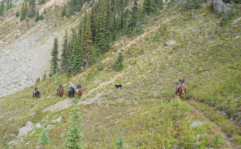
There are three different access routes to the Silvercup ridge, choose the one you are interested in. Via American Creek Road: From the boulder barricade to the ridge, the trail follows the road through subalpine and alpine terrain. Panoramic views into the Lardeau Range and Goat Range and an abundance of wild flowers enhance the walk up to the ridge. Upon cresting the ridge, there is an intriguing view into Healy Creek and across to Mt. Aldridge and Razors Edge. The Silvercup Trail offers a superb opportunity to enjoy an extended ridge walk through alpine and subalpine terrain. If the entire ridge is walked, it is 25 km from the trail head on American Creek road to the trail head on Dirt Road. There is not a continuous trail along the ridge, it is a combination of clearly defined trail and cairned route. Good footgear, map reading and navigation skills are required. Travelling the ridge in poor weather is not recommended. Via Copper Queen Road: The Copper Queen Road offers road access onto one of the most beautiful ridges in the Arrow and Kootenay Lake Forest Districts. Upon reaching the ridge one has a choice of either following the trail northwest along the ridge to the Dirt Road trail head, or heading southeast to the trail head on American Creek. If you are using the road, it peters out near the timberline on the Dirt Road trail and is blocked by boulders on the American Creek Road. Via the Dirt Road: The first 0.5 km of the trail may be difficult to follow, as it cuts up and back across a harvested area. Silvercup Ridge offers a superb opportunity to enjoy an extended ridge walk through alpine and subalpine terrain. Views into the Badshot Range and across to the Lardeau Range are spectacular. Visitors to this area will wish they had more time to go over the “next ridge” as there are many opportunities for side trips all along Silvercup Ridge.
Driving Directions:Access to American Creek Road : From the bridge over the Lardeau River at Gerrard, proceed north on Hwy #31 for 0.4 km to an unsigned road. Proceed for 4.1 km on this unsigned road to a junction on a curve. Stay straight ahead at this junction, following an older, brushed in road. At km 6.9 take the switch back to the left and up. This section of the road has steep sections with windfalls and is eroding in places. From 8.7 km, to the trail head at 11.9 km, you will require a 4×4 vehicle, or you can shoulder your pack and walk up the road. At 11.9 km, boulders block the road to all vehicular traffic. There is a parking area for about 3 vehicles, with room to turn around. Access to Copper Queen Road: From the bridge over the Lardeau River at Gerrard, proceed north on Hwy #31 for 17.9 km to an unsigned road. Turn right and proceed up this road for 6.2 km. Then, take a small, older road that turns back and up to the right. Follow this old road for 1.9 km to a fork in the road. Take the left fork and continue 0.5 km up to the timberline. From here you will need a 4×4 to go the last 0.7 km to the mining road that runs along the ridge. Although it is possible to drive almost the entire length of Silvercup Ridge on this mining road, please, refrain from leaving the road as the alpine and subalpine meadows are very fragile. The original old trail can be accessed by foot from many places along the mining road. One of the best places is just where the Copper Queen Road meets the road along the ridge. From here the trail is just above the mining road. Access to Dirt Road: From the gas station on Hwy #31 in Trout Lake, proceed south on Hwy #31 for 8.3 km to an unsigned road. Turn back and up onto this road. A high clearance vehicle will be required to negotiate the water bars. Follow this road (driveable for 1.8 km) for 3.2 km to the trail head. The trail head may be hidden by alders. Keep a sharp eye open for a 4×4 brown post with white letters on the uphill side of the road.
( rec sites and trails )
