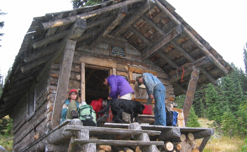
Steed Hut

At 2320 metres, Siwash Mountain is the highest peak in the Bonnington Range, and the Steed Cabin, a snug wood cabin built by the KMC in 1995, lies due south of the summit of Siwash Mountain by a small tarn at 2100 metres. A loft in the cabin can sleep four (no foam mattresses), while the downstairs is equipped with table, bench seats and a wood stove. Basic cooking utensils (pots, pans, cups, bowls, plates, cutlery, etc.) are stored in a plastic bin. There is also a two burner white gas Coleman Stove and Coleman Lantern (take spare mantels). You will need to bring your own white gas for the stove and lantern. There is NO water at the Steed Cabin in either summer or winter. The area around the Steed Cabin is popular with snowmobilers, so expect to see snowmobilers when you are staying at the cabin.The cabin is maintained under partnership agreement with Kootenay Mountaineering Club. For detailed information and driving directions please visit: http://www.kootenaymountaineering.bc.ca

Driving Directions: In winter, it takes two days to reach the cabin via the Bonnington Traverse route. In the summer, a four wheel drive vehicle is not necessary. It is possible to drive to the head of Glade Creek, from here, it is between one and three hours of bushwhacking (thick bush with many black and grizzly bears in the area) to reach the cabin. Follow the following driving directions for summer access. Set your odometer to 0 on Highway 3 at Bombi Summit. 0 km = Munson Road and Highway 3, 2.6 km = powerline spur to (R) 3.7 km = Lower Munson to (L), stay (R), 3.9 km = West Munson to (L), stay (R), 5.4 km = East Munson to (R), stay (L), 6.3 km = spur to R, stay on mainline, 6.4 km = spur to (R) is Grassy access, 10.8 km = small pass, road enters from behind and (L), stay straight down the hill, 11.0 km = road forks, go (R) to stay on Munson Road, (L) fork is North Munson, 15.1 km = pass below Twin Peaks, 18.9 km = fork in road, go (L), 22.6 km, = park here and walk the rest of the way.

( source: rec sites and trails )
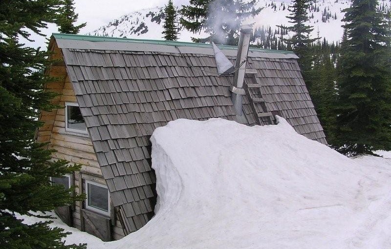
Grassy Mountain Hut

Grassy Hut lies in the middle of the horseshoe just below the pass between Grassy and south Grassy Mountains. The cabin was built by the KMC in 1985, has four bunks (no foam mattresses), a bench table and seating, and a wood stove. Basic cooking utensils (pots, pans, cups, bowls, plates, cutlery, etc.) are stored in a plastic bin. There is also a two burner white gas Coleman Stove and Coleman Lantern (take spare mantels). You will need to bring your own white gas for the stove and lantern. There is NO water at the Grassy Cabin in either summer or winter. A two hectare area around the cabin is designated for non-motorized use only.The cabin is maintained under partnership agreement with Kootenay Mountaineering Club. For detailed information and driving directions please visit: http://www.kootenaymountaineering.bc.ca/grassy.html

Driving Directions: Access in summer and winter is via logging roads out of Bombi Summit. Follow the following driving directions for summer access. Set your odometer to 0 on Highway 3 at Bombi Summit. 0 km = Munson Road and Highway 3, 2.6 km = power line spur to (R), 3.7 km = Lower Munson to (L), stay (R), 3.9 km = West Munson to (L), stay (R), 5.4 km = East Munson to (R), stay (L) 6.3 km = spur to R, stay on mainline, 6.4 km = spur to (R) is Grassy access. Drive a short distance up this road (about 100 metres) and then park. If you have a two wheel drive vehicle, you will have to park off the main road and walk from there. On foot, follow the old road that leads up to the ridge south of Grassy Mountain. Hike downhill (sketchy trail) to find the cabin. Allow one to three hours hiking time. In winter, follow the same directions but ski directly from the highway. Allow four to six hours.

BlackJack Cross Country Ski Club

Black Jack is considered one of the premier cross-country ski facilities in western Canada due to the excellent grooming, variety of trails, abundant reliable snowfall, and convenience of our proximity to Rossland. Blackjack offers Approx 40km of expertly groomed trails for both classic skiing and skate skiing, 2.5km lit night-skiing loop, A terrain park for kids, A large trailhead cabin, Two trailside warming cabins, A doggy loop , A biathlon range, and Beautiful trails and beautiful views. The ski season usually starts in late November and goes well into April. Visit www.skiblackjack.ca for full details on fees.

Driving Directions: From Rossland , take highway 3B North towards Red Mountain. 500m past Red Mountain, turn right on Mann Road and follow the signs for less than 1km to trailhead chalet and parking lot.