Barrett Lake

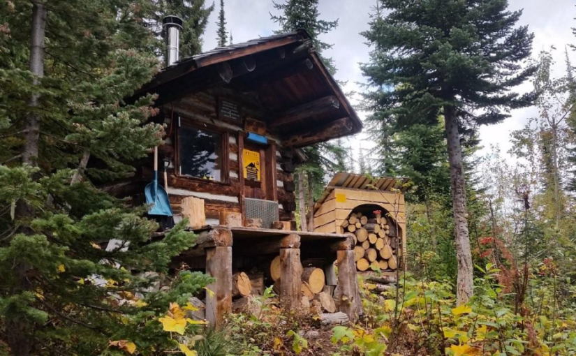
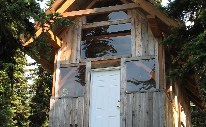
Barrett Lake is a beautiful little mountain lake with a small rustic cabin on the shores. There are opportunities for Quading, hiking, fishing, and camping. Barrett Lake is at 1800 Meters. Popular in the winter for snowmobiling and ski touring.

Driving Directions: Access to the Barrett Lake is via Porto Rico Road, 15 km south of Nelson off Highway 6. In summer you can drive up 3 km and park there. (Recommended Quad Access Only from this point). From here you take the lower fork in the road up another 3 km (this section of road is deactivated but is passable in a high clearance 4X4) to a junction, take a right here (about 6 KM up in total). From here, follow the really rough and rocky road for another 4.5 Km up to the lake, stay on the main road on the way up. The last 4.5 Km is extremely rough, and heads to the East up the drainage crossing a South facing rocky slope.

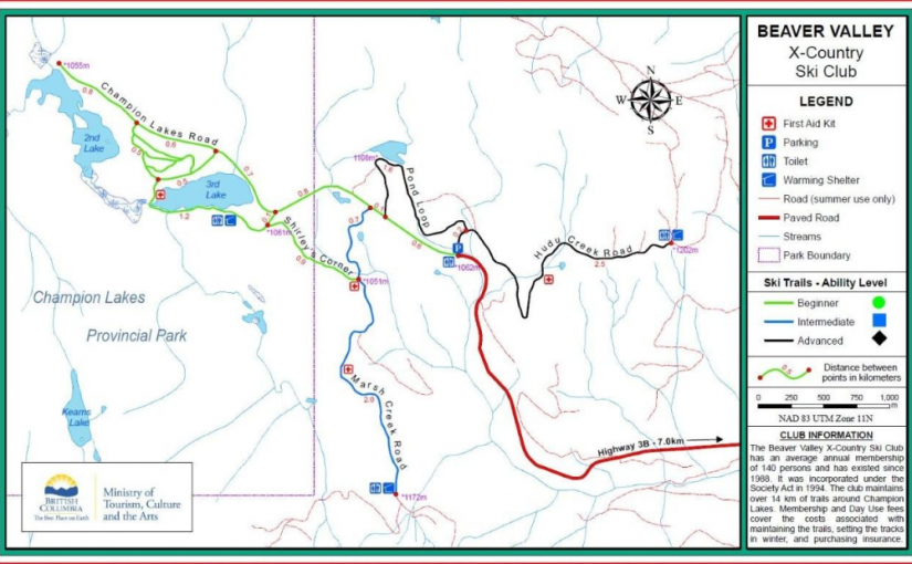
Beaver Valley Champion Lakes Cross Country Trails

The Beaver Valley Cross Country Ski Club provides winter maintenance of the trail system and track setting as well as warming shelters for day use. 14 km of the trail system is within Champion Lakes Provincial Park and another 6 km are outside the park boundary.

Driving Directions:The Beaver Valley Cross Country Ski Trails are situated 17 km Nortwest of Fruitvale with access provided by Highway #3B and the Champions Lakes road.

Steed Hut

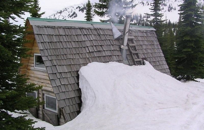
At 2320 metres, Siwash Mountain is the highest peak in the Bonnington Range, and the Steed Cabin, a snug wood cabin built by the KMC in 1995, lies due south of the summit of Siwash Mountain by a small tarn at 2100 metres. A loft in the cabin can sleep four (no foam mattresses), while the downstairs is equipped with table, bench seats and a wood stove. Basic cooking utensils (pots, pans, cups, bowls, plates, cutlery, etc.) are stored in a plastic bin. There is also a two burner white gas Coleman Stove and Coleman Lantern (take spare mantels). You will need to bring your own white gas for the stove and lantern. There is NO water at the Steed Cabin in either summer or winter. The area around the Steed Cabin is popular with snowmobilers, so expect to see snowmobilers when you are staying at the cabin.The cabin is maintained under partnership agreement with Kootenay Mountaineering Club. For detailed information and driving directions please visit: http://www.kootenaymountaineering.bc.ca

Driving Directions: In winter, it takes two days to reach the cabin via the Bonnington Traverse route. In the summer, a four wheel drive vehicle is not necessary. It is possible to drive to the head of Glade Creek, from here, it is between one and three hours of bushwhacking (thick bush with many black and grizzly bears in the area) to reach the cabin. Follow the following driving directions for summer access. Set your odometer to 0 on Highway 3 at Bombi Summit. 0 km = Munson Road and Highway 3, 2.6 km = powerline spur to (R) 3.7 km = Lower Munson to (L), stay (R), 3.9 km = West Munson to (L), stay (R), 5.4 km = East Munson to (R), stay (L), 6.3 km = spur to R, stay on mainline, 6.4 km = spur to (R) is Grassy access, 10.8 km = small pass, road enters from behind and (L), stay straight down the hill, 11.0 km = road forks, go (R) to stay on Munson Road, (L) fork is North Munson, 15.1 km = pass below Twin Peaks, 18.9 km = fork in road, go (L), 22.6 km, = park here and walk the rest of the way.

( source: rec sites and trails )
Erie Creek Rec Site

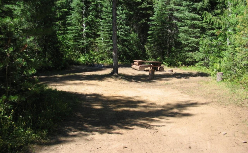
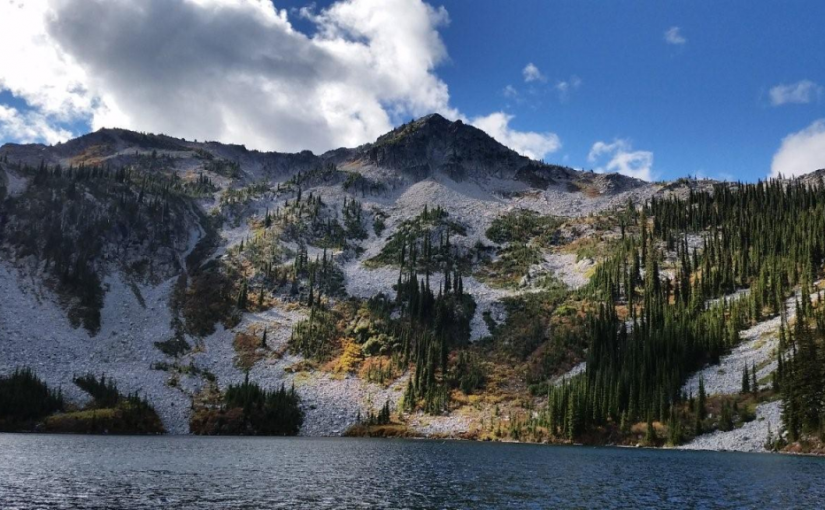
The Erie Creek Recreation Site is one of the few recreation sites large enough to accommodate groups of 3 or 4 vehicles. The sites are in a semi-open forest, offering shade in the hottest part of the day. Located beside crystal clear Erie Creek

Driving Directions:From the junction of Highway 3B and 3/6 in Salmo, travel 3.6 km west towards Trail, on Highway 3. Just before a small bridge over Erie Creek, turn right onto the “Second Relief Road”. This road is paved for the first 200 meters, then turns into a good 2 wheel drive gravel road. Within 1 km you will see the “Erie Creek Forest Service Road” sign. Continue up this road. The road forks at 7 km, stay straight ahead (to the left). The road forks again at 8.5 km, again stay left, descending into the valley. Cross over the bridge, at 10 km. The recreation site is on your right.

( source : Rec sites and trails )

Giveout Creek Cabin

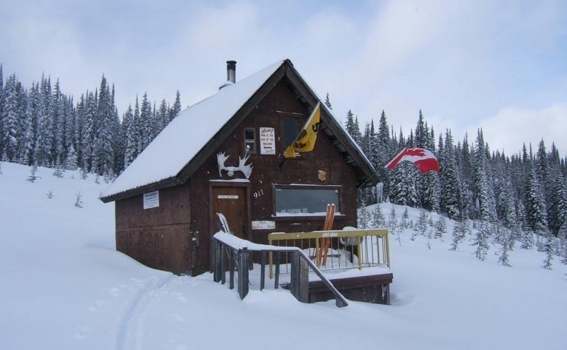
The cabin overlooks the Nelson Valley at an elevation of 1730 Meters. The cabin is primarily used for a warming hut for snowmobilers. There are a few bunks in the cabin for overnight use. There is good snowmobiling in the cut blocks surrounding the cabin and in and around the old mining sites.

Driving Directions:The cabin can be accessed off of Hwy 8 to Ymir out off Nelson. Turn east onto Giveout Creek FSR for +/- 1.6 km and then onto Gold Creek FSR for +/- 5 Km, then bear right at the junction. Follow this road for 3 more KM . At this point there is an old logging skid road for 300 meters up to the cabin. There is usually lots of snowmobile tracks leading to the cabin. The trail in is occasionally groomed by the nelson sno-goers club. Cabin Location is N49�25.602 W117�17.722

more information at http://nelsonsno-goers.webs.com/

Huckleberry Hut

Huckleberry Hut is a cosy log cabin situated at around 1600 metres in the valley below Midday and Cabin Peaks. It is a small hut with two bunks (no foam mattresses) which will each sleep two. There is also a fold-down table, wood stove and outhouse, and basic cooking utensils (pots, pans, cups, bowls, plates, cutlery, etc.) There is a two burner white gas Coleman Stove and Coleman Lantern, bring spare mantels and white gas. The cabin is maintained under partnership agreement with Kootenay Mountaineering Club. For detailed information and driving directions please visit: http://www.kootenaymountaineering.bc.ca

Driving Directions: Access to the Huckleberry Hut is via Porto Rico Road, 15 km south of Nelson off Highway 6. In summer, with a high clearance four wheel drive vehicle you can drive for six kilometres to a junction where an old road leads off to the left. Park here, and walk the remaining two kilometres to the cabin. In winter a combination of snowmobiles and ski touring gear may be required. The cabin is maintained under partnership agreement with Kootenay Mountaineering Club. For detailed information and drining directions please visit: http://www.kootenaymountaineering.bc.ca/huckleberry.html

Ripple Ridge Cabin

Very popular as a ski touring destination. Typically about one hour ski tour to the cabin with no avalanche danger. There are a few tours accessible from the cabin including Baldy Rocks, Lightening Strike and Ripple Peak/Twin Lakes and lots of yo-yo skiing in moderate terrain.

Site Description: The Ripple Ridge Cabin can be booked by going to www.rippleridge.ca There is a $10 fee per person for overnight use of the cabin. The cabin contains a wood stove, tables and benches, and a sleeping loft. It can sleep 6 comfortably, and 10 in a squeeze. Please note that no motorized vehicles are allowed on this road in the winter. A picnic table and fire ring were added in October 2010.

Driving Directions: From Salmo take Highways #6 and #3 southeast for 37 km to Stayleep pass at Bridal Lake. Park in the plowed area on the left side of the highway. From the junction of Highways #3 and #3A north of Creston take highway #3 northwest for 42.5 km to the pass at Bridal Lake. Park in the plowed area on the north side of the highway. From the parking area, cross the highway towards the south. The gravel road accessing the cabin begins immediately to the right of the Highway’s maintenance yard. Take this road 3.2 km to the top of the ridge where it levels off and before it drops into the next valley. Look for the trail into the cabins on the right at this point. The old cabin lies about 200 metres from the access road, and the new cabin about 100 metres further. high clearance 2WD required.

Winter Access: Park in the parking lots on the north side of the highway and cross the highway on the west side of the parking lot to access the summer road. Follow the trail up until it levels off and before it drops into the next valley. Look for the trail into the cabin on the right at this point.

Kootenay Pass – Cornice Ridge  ( NoName Ridge)

Location: Kootenay Pass – north
Time: half-full day
Difficulty: Moderate
Distance: 2km
Elevation Gain: 1800 feet
Map: 82 F/3 82 F/2

Start on the Caribou trail above the warming hut and traverse right up the ridge. Skiing back down to the lake from this point is very popular, however typically wind effected. The south-west slopes above are controlled for the highway. On a good day you can see forever from the summit, and runs are typically back down the ridge, or dropping in on the North-east side with traverses back to the ridge and the Pass. Lots more options if you drop North with trips to Wolf Pass. The runs are moderately steep and steeper are require good evaluation techniques.