Wensley Creek Cross Country Ski Area

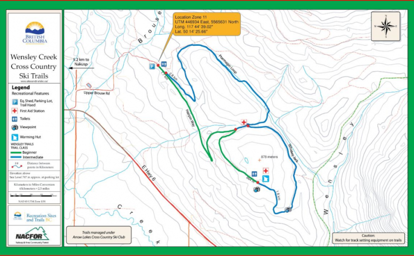
Wensley Creek Cross Country Ski Trails offer 9 kilometres of groomed classic track skiing for both beginner and intermediate skiers. The trail is usually ready for skiing by mid-late December, and the season extends through to late March, with variable conditions throughout the season and even along different sections of the trail. Bringing a variety of waxes is recommended. Horseback riding, hiking, and mountain biking are available in the off season.

Driving Directions:Head south from Nakusp on Highway 6 toward Nelson for about 4 kilometres, Turn left on Upper Brouse Road and follow it to the top through a series of turns until reaching the parking area for the trails.

(source: rec sites and trails )

Beaver Valley Champion Lakes Cross Country Trails

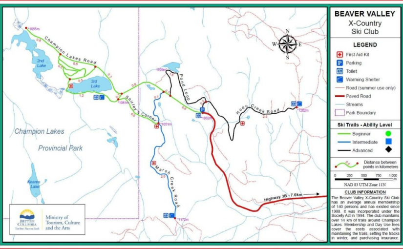
The Beaver Valley Cross Country Ski Club provides winter maintenance of the trail system and track setting as well as warming shelters for day use. 14 km of the trail system is within Champion Lakes Provincial Park and another 6 km are outside the park boundary.

Driving Directions:The Beaver Valley Cross Country Ski Trails are situated 17 km Nortwest of Fruitvale with access provided by Highway #3B and the Champions Lakes road.

BlackJack Cross Country Ski Club

Black Jack is considered one of the premier cross-country ski facilities in western Canada due to the excellent grooming, variety of trails, abundant reliable snowfall, and convenience of our proximity to Rossland. Blackjack offers Approx 40km of expertly groomed trails for both classic skiing and skate skiing, 2.5km lit night-skiing loop, A terrain park for kids, A large trailhead cabin, Two trailside warming cabins, A doggy loop , A biathlon range, and Beautiful trails and beautiful views. The ski season usually starts in late November and goes well into April. Visit www.skiblackjack.ca for full details on fees.

Driving Directions: From Rossland , take highway 3B North towards Red Mountain. 500m past Red Mountain, turn right on Mann Road and follow the signs for less than 1km to trailhead chalet and parking lot.

Nelson Nordic Ski Club

Cross-country ski area run by the Nelson Nordic Ski Club. Memberships or daily fees are required to use the network of trails, including the Clearwater and Euphrates trails.

Driving Directions: From Nelson, 10 KM South on Hwy 6. Park at either the parking lot across the road from the Whitewater Ski Area access road or continue another 300m on left for the Clearwater/Euphrates trails.

Sproule Creek Trail

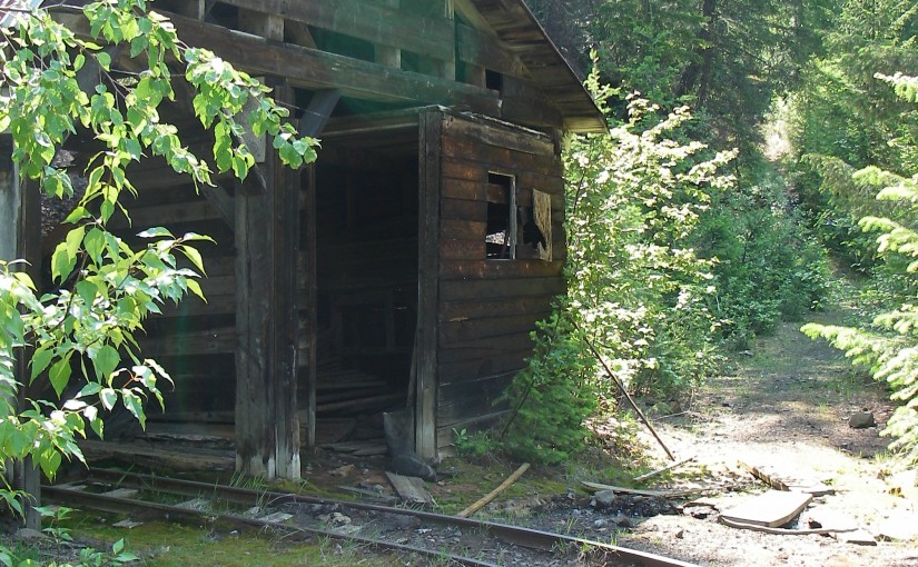
This trail follows an old wagon trail and railroad constructed by the A.G. Lambert Lumber Co. Ltd. between 1919 and 1930. The trail provides access to the old mill site and opportunities for ridge-top hiking. The Westside loop is a cross country ski loop. It is rough and not suitable for hiking or riding. The east fork trail is a short 1.5 km (one way) trail of moderate difficulty. The gentle slope of trail gives it an “easy” rating, although there are some rough sections. The trail is used by mountain bikers, horseback riders, hunters, cross-country skiers, and hikers.

Driving Directions:From the community of Nelson, head west along highway #3A for 11.3 km to Sproule Creek Road. Follow this road for 4.0 km to the parking lot. The trailhead is located approximately 100 m up a private drive on the west side of the creek. This road is suitable for 2wd vehicles.

(source: Rec Site and Trails )

K&S Railway ( Sandon )

Site Description:The K & S Railway Trail can be done in many ways. No matter how you do it, be sure to give yourself time to poke around the old mine sites, admire the rock work and pause to take in the views. From Sandon to Payne Bluff is an easy stroll. To make it easier, drive the first 2.3 km and then it is only 3.8 km to Payne Bluff. If you have a way back from Three Forks, you can take the old pack trail, down to the highway from Payne Siding. If you want a bit of a workout, start at Three Forks. The first section of trail takes you to the old CPR grade. Follow this for 300 metres, then look for a sign that directs you to the left and up, onto the old pack trail. After a steep 1.4 km you are at Payne Siding. Turn left to Payne Bluff, which is 300 metres along the railway grade. Biking? The first 2.5 km from Sandon is a pleasant family bike ride. After this, the trail becomes single track and somewhat technical.

Driving Directions:Access to the Sandon end of the K & S: At the junction of Hwy 6 and 31A in New Denver, turn east onto Hwy 31A. Proceed for 8.3 km to the turn off to Sandon. This junction is known as Three Forks. Proceed 5.5 km to Sandon. Rather than going over the bridge, continue straight ahead on Reco Street for 500 metres to the “K & S Historic Railway Trail” interpretive sign and trail head. If you would like an easy family bike route, the next 2.3 km along the railway grade to the Altoona Mine, has a gentle grade and is wide. This section of the trail is also suitable for 2 wheel drive vehicles or a pleasant walk. Access from Three Forks to the K S: At the junction of Hwy 6 and 31A in New Denver, turn east onto Hwy 31A. Proceed for 8.3 km to the turn off to Sandon. Park at the trail head sign on Hwy 31A, 100 metres north of this junction.

( rec sites and trails ) NORTH SLOCAN TRAILS SOCIETY