Steed Hut

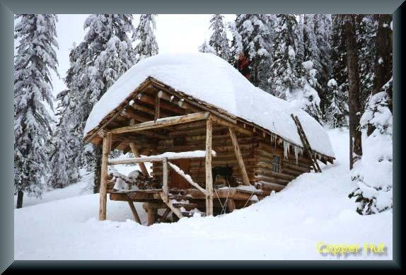
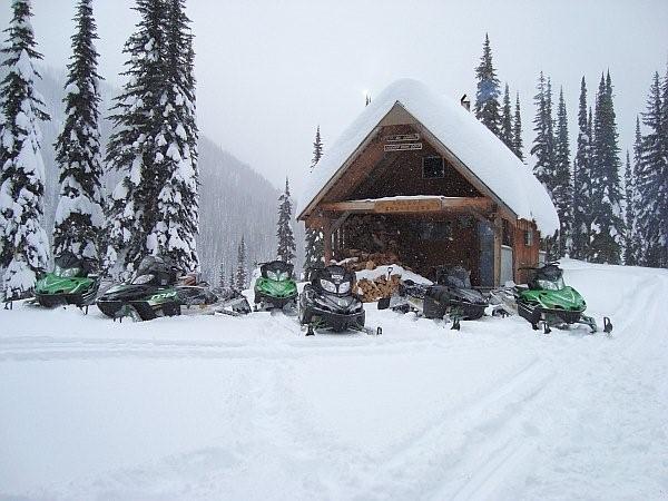
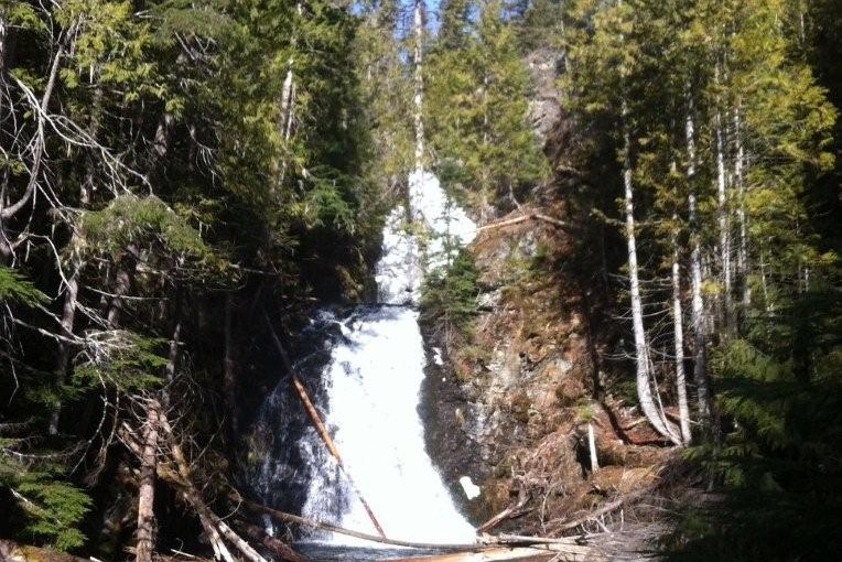
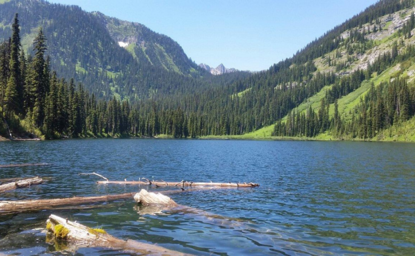
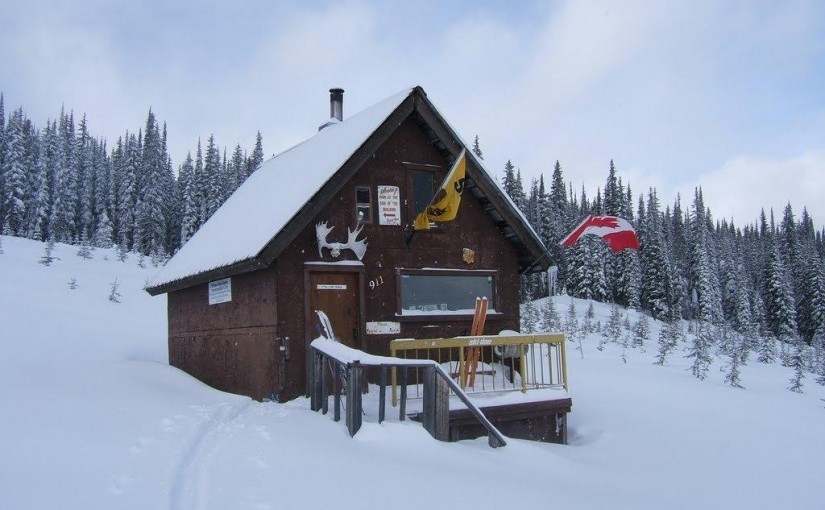
At 2320 metres, Siwash Mountain is the highest peak in the Bonnington Range, and the Steed Cabin, a snug wood cabin built by the KMC in 1995, lies due south of the summit of Siwash Mountain by a small tarn at 2100 metres. A loft in the cabin can sleep four (no foam mattresses), while the downstairs is equipped with table, bench seats and a wood stove. Basic cooking utensils (pots, pans, cups, bowls, plates, cutlery, etc.) are stored in a plastic bin. There is also a two burner white gas Coleman Stove and Coleman Lantern (take spare mantels). You will need to bring your own white gas for the stove and lantern. There is NO water at the Steed Cabin in either summer or winter. The area around the Steed Cabin is popular with snowmobilers, so expect to see snowmobilers when you are staying at the cabin.The cabin is maintained under partnership agreement with Kootenay Mountaineering Club. For detailed information and driving directions please visit: http://www.kootenaymountaineering.bc.ca

Driving Directions: In winter, it takes two days to reach the cabin via the Bonnington Traverse route. In the summer, a four wheel drive vehicle is not necessary. It is possible to drive to the head of Glade Creek, from here, it is between one and three hours of bushwhacking (thick bush with many black and grizzly bears in the area) to reach the cabin. Follow the following driving directions for summer access. Set your odometer to 0 on Highway 3 at Bombi Summit. 0 km = Munson Road and Highway 3, 2.6 km = powerline spur to (R) 3.7 km = Lower Munson to (L), stay (R), 3.9 km = West Munson to (L), stay (R), 5.4 km = East Munson to (R), stay (L), 6.3 km = spur to R, stay on mainline, 6.4 km = spur to (R) is Grassy access, 10.8 km = small pass, road enters from behind and (L), stay straight down the hill, 11.0 km = road forks, go (R) to stay on Munson Road, (L) fork is North Munson, 15.1 km = pass below Twin Peaks, 18.9 km = fork in road, go (L), 22.6 km, = park here and walk the rest of the way.

( source: rec sites and trails )

Mt Buchanan Fire Lookout

This is a high elevation day-use site which is located at an refurbished fire lookout building. This is a great spot for family oriented outings; views are spectacular and flowers are lovely in season. There is also a 2 km loop trail below the lookout that provides access to viewpoints on the rock bluffs. Interpretive displays on fire lookouts in the tower.

Mountain Bike trails start from here ( AKA The Monster )

Driving Directions: From Kaslo, head west on highway #31A for 11 km to the Blue Ridge Forest Services Road, then follow signs. Follow the main road for 11.9 km to the lookout, staying right at the 7.0 km junction. This road is suitable for 2wd vehicles.

(source: rec sites and trails )

Cooley Lake Rec Site

The drive up to Cooley Lake is a good outing, even if you are not a fisherman. The Goose Creek swimming holes by the bridge (at km 1.5) are worth stopping at on a hot day. Near the 10 km sign on the “Goose Creek Road”, the road traverses an open ridge giving panoramic views of the Bonnington Range, the Valhallas, Shoreacres, Crescent Valley and Krestova. Cooley Lake is a very popular fishing lake that is stocked with rainbow trout. Access to the lake shore is on a short hiking trail through a dense sub-alpine forest. Fishing is done from logs jutting out from the shoreline. There are no tent sites at the lake. Campers stay at the trailhead, just off the road.

Driving Directions:From the junction of Highway 3 and 22, at the overpass in Castlegar, travel east on Highway 3 and Highway 3A towards Nelson for 5.1 km. Turn right at the “Syringa Creek Turn Off” sign onto the “Robson Access Road”. Follow this road for 2.8 km. Turn right onto the “Pass Creek” road. Follow this winding paved road for 11.5 km. Turn left onto the “Goose Creek Road”. The pavement soon gives way to a good 2 wheel drive gravel road that climbs steadily. At 7 km stay right, crossing over Gander Creek. At 9 km stay right, crossing over another small bridge. At 9.3 km stay left, following the main road. At 13.3 km you will get glimpses of Cooley Lake on your right. The parking area for the trail to Cooley Lake is at 13.6 km.

Copper Mountain hut

Lying in a thicket of large trees near 2000 metres in a basin on the southwest side of Copper Mountain, the cabin is surrounded by a two hectare area for non-motorized use only. The Copper Mountain cabin is equipped with three bunks (can sleep two each top to tail, no foam mattresses), a wood stove, seating bench and table. Basic cooking utensils (pots, pans, cups, bowls, plates, cutlery, etc.) are stored in small kitchen cabinet. There is also a two burner white gas Coleman Stove and Coleman Lantern (take spare mantels). You will need to bring your own white gas for the stove and lantern. There is NO water at the Copper Mountain Cabin in either summer or winter.The cabin is maintained under partnership agreement with Kootenay Mountaineering Club. For detailed information and driving directions please visit: http://www.kootenaymountaineering.bc.ca

Driving Directions: In summer, the normal access is via an old logging road in 49 Creek. This road leaves the small community of Blewett west of Nelson and is signed �May and Jenny Road� off Blewett Road (exits to your left as you head west). A high clearance four wheel drive is necessary. Follow May and Jenny Road (becomes Copper Mountain Road) for about 12 km to a pass between Red Mountain and Copper Mountain. Either park at the pass (limited) or continue a further 150 metres along the road to a slightly larger parking area. There are no signs. Follow the old road on foot to reach the ridge south of Copper Mountain. An ATV track leads down to the cabin. Allow one to three hours walking time. Winter access is more difficult as the summer route crosses extensive avalanche paths and is unsafe for most of the winter. It is possible to access the Copper Mountain Cabin from roads in the Snowwater Creek drainage. Route finding skill is necessary. Most winter visitors to the cabin are staying at the cabin as part of the Bonnington Range traverse and will have skied across from the Steed Cabin.

Crusader Cabin Rec Site

This site offers an excellent snowmobiling in the winter. The cabin sleeps 6 comfortably . The Crusader is managed under partnership agreement by the Nelson Sno-Goers and bookings can be made by going to http://nelsonsno-goers.webs.com/ There is a $10 fee per person for overnight use of the cabin. The Fees collected will go directly back into the cabin for maintenance and up-keep.

Driving Directions:Travel north from Nelson on highway #3A for 8.0 km to Six Mile Lakes Road (left hand turn off hwy). Follow Six Miles Lakes main road for 10.0 km to a fork in the road, take the right fork. At 13Km you will find the lakes and the Six Mile Lakes Recreation Site. At 18.5 KM you will reach a major junction in the road, proceed straight; the sharp left will take you down lemon Creek FSR). Stay on the main line until 26.5 Km Reach a junction, where you take the left fork. At 29.5 Km there is a junction, from here there is off road snowmobile trails that lead to the cabin. Cabin GPS Coordinate is 49�46.203 X 117�19.893.

Deer Creek Falls Rec Trail

Deer Creek Falls is an easy walk on a good trail. This trail is suitable for all ages and abilities. Along the trail, are some unusually large white pine and Ponderosa pine trees. As the trail descends gently into the creek draw, the temperature drops, making this a good trail for a hot day. The Deer Creek Falls cascade in two tiers through the gorge. The upper fall is narrow and drops into a pool before cascading over the lower fall. The crystal clear pool at the foot of the lower fall invites dabbling. The entire scene is framed by a lush cedar forest. Bring a picnic lunch to enjoy at the table, while you cool off by the falls. In the autumn, look for mushrooms on the lower portions of the trail. At other times of the year, shade loving plants such as Indian Pipe can be found. On your way up the trail, rest on the bench and take in the peace and quiet of the forest. The only sounds you will hear will be the birds in the forest.

Driving Directions:Just before the yellow gates in Syringa Creek Provincial Park, turn right onto the “Deer Park Forest Service Road”. Follow this narrow, good 2 wheel drive gravel road for approximately 13.5 km. Turn right onto the “Deer Creek Forest Service Road”. Follow this road for 3.5 km. Turn off to the left, onto a dirt track. Park at the trailhead.

( source: rec sites and trails )

Erie Creek Rec Site

The Erie Creek Recreation Site is one of the few recreation sites large enough to accommodate groups of 3 or 4 vehicles. The sites are in a semi-open forest, offering shade in the hottest part of the day. Located beside crystal clear Erie Creek

Driving Directions:From the junction of Highway 3B and 3/6 in Salmo, travel 3.6 km west towards Trail, on Highway 3. Just before a small bridge over Erie Creek, turn right onto the “Second Relief Road”. This road is paved for the first 200 meters, then turns into a good 2 wheel drive gravel road. Within 1 km you will see the “Erie Creek Forest Service Road” sign. Continue up this road. The road forks at 7 km, stay straight ahead (to the left). The road forks again at 8.5 km, again stay left, descending into the valley. Cross over the bridge, at 10 km. The recreation site is on your right.

( source : Rec sites and trails )

Fletcher Lake Rec Site

This is a steep rustic trail into an alpine lake area. The trail starts on a skid road in a cutblock, and winds its way through dense sub-alpine forest and creekside vegetation to the east end of the lake. The area is heavily used by grizzly bears and site users should take care to make noise when hiking. Hike in groups, and store food out of bear-reach and well away from campsites. The site provides good backcountry camping and fishing. Please pack “ALL” your garbage out with you so bears are not attracted to the area.

Driving Directions:From Balfour, drive 23.0 KM along highway 31 towards Kaslo, and turn left onto a dirt road (4.2 KM north of the Woodbury Creek Resort). Zero your odometer at the start of the Woodbury-Fletcher FSR. At 1.1 KM (the crest of the hill) turn right on to Fletcher Creek Road. At 2.8 KM take the left fork. At 3.7 KM bear right. At 7.3 Km stay left. At 11.5 go right and begin to drive though recent logging. Road is very rough from here (high clearance 4×4) with deep water bars. At 12.5 KM park at the old logging landing. From here walk a few hundred feet along an old de-activated road to find the trail head going off up to the left.

(source: rec sites and trails)

Garland Bay Rec Site

This is an enhanced site and has a $12 per night charge. Garland Bay is a large open beach site on the east shore of Kootenay Lake. This site receives very heavy use during the summer season. Very popular area for swimming, camping, fishing and boating. 22 campsites.

Driving Directions: From the community of Riondel on the east shore of Kootenay Lake, take a right turn on to Eastman Avenue and proceed to Tam O’Shanter Creek. Take the Kootenay Lake East forest service road 9.0 km to the Bernard forest service road junction, then take the left fork for 4.0 km to the site. The road is suitable for 2wd vehicles.

(source: rec sites and trails )

Giveout Creek Cabin

The cabin overlooks the Nelson Valley at an elevation of 1730 Meters. The cabin is primarily used for a warming hut for snowmobilers. There are a few bunks in the cabin for overnight use. There is good snowmobiling in the cut blocks surrounding the cabin and in and around the old mining sites.

Driving Directions:The cabin can be accessed off of Hwy 8 to Ymir out off Nelson. Turn east onto Giveout Creek FSR for +/- 1.6 km and then onto Gold Creek FSR for +/- 5 Km, then bear right at the junction. Follow this road for 3 more KM . At this point there is an old logging skid road for 300 meters up to the cabin. There is usually lots of snowmobile tracks leading to the cabin. The trail in is occasionally groomed by the nelson sno-goers club. Cabin Location is N49�25.602 W117�17.722

more information at http://nelsonsno-goers.webs.com/