Blaster’s Ridge & Prospector’s

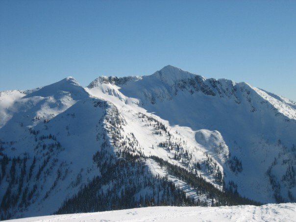
Location: Whitewater Ski Area. Purchase a single ridge ticket and ride the Summit Chair.
Time: Half day
Difficulty: Moderate
Distance: Short
Elevation_Gain: 200 meters
Map: 82 F/6
Avalanche Exposure: Challenging

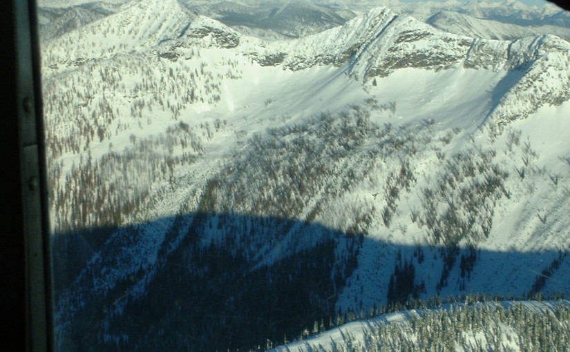
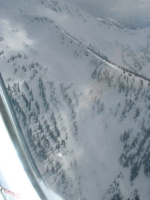
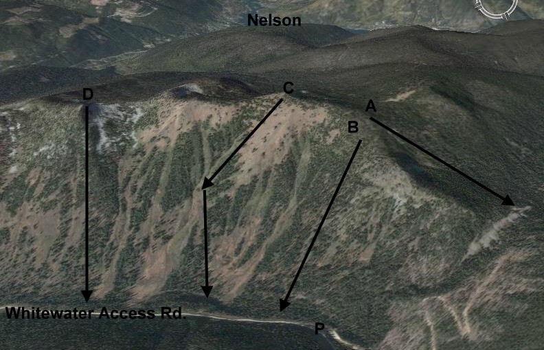
From the top of the Summit Chair ski left along the run on the top of the ridge. Stop at the top of Motherlode and look for the Ski Patrol Warning Sign in the little dip before the traverse. The route stays closely on the ridge and is used by the Ski Patrol as a safe route to the top of their blasting run during high avalanche conditions. After numerous tight switchbacks the top of the ridge is gained. A steep tree glade named “Garbage Chutes” is an exciting descent next to the route of ascent. There are a series of progressively steeper lines ( N facing ) that continue for the next kilometer along this ridge. The trip out to Sherpa Valley takes the flat ridge to the South with cliffs lining the right hand side. After five hundred meters you will break into a small bowl, known as Sherpa Valley. If you would continue further along the ridge you end up dropping down very low km7 on the access road and Mama and Papa Bear Chutes are down that way too. Alternatively traversing left above the ski area takes you to Prospector Bowl which has some amazing steep lines leading back into the ski area. Climbing further past from Prospector’s takes you into the entrance for West Ymir and continuing on from there takes you to the summit of Ymir Peak along with the south facing lines H8 and the south face of Ymir Peak.

Ymir Peak & Bowl

Location: Whitewater Ski Area
Time: Half day – Full Day
Difficulty: Moderate
Distance: 3km
Elevation Gain: 1500 feet
Map: 82 F/6
Avalanche Exposure: Complex

A number of options are available to gain access to Ymir Bowl and Ymir Peak. The ridge line from Blasters ridge to the summit is the longest route but the most scenic and safest. Alternatively from the White Queen Pass climbing up the ridge and traversing high under the rocks over steep terrain and gaining the ridge. The ridgetop is called Half Dome and good runs can be made form here into Five Mile. From just below the final climb to Half Dome a traverse can be made into Ymir bowl. Ymir Bowl is not a good place to be unless Avalanche conditions are very stable. Once in the bowl Kututle Pass is an interesting destination or Ymir Peak can be gained from the bench just to the left of the Peak. The route to and from the Peak involves careful manoeuvring on rocks and snow on the steep East slopes of Ymir Peak.

Ymir Bowl From lookers left to right

Five Mile Saddle above the lift, Goat’s Slide, Half Dome, Scob’s Knob ( the treed knob within the bowl ), Kututle Notch, Cookie Cliffs, Kuba Chute, Ymir Peak, Dogs Leg, First Choice, Pencil Chute, West Ymir, and Prospector’s Bowl at the edge of the ski area.

Five Mile and White/Black Queen

Location: Whitewater Ski Area. Skin to the top of Yankee Girl.
Time: Half Day – Full Day
Difficulty: Easy
Distance: 3 km
Elevation Gain: 1500 feet
Map: 82 F/6
Avalanche Exposure: Challenging 

FiveMileTrees
from helicopter with Ymir Bowl in background, Half-Dome out of view on top left and the Five Mile Ridge on right hand side typically where skiers emerge from the climb from Whitewater Ski Area.

From the top of the Yankee Girl ski run proceed outside the Ski Area, zigzagging directly upwards to gain the pass ( 15-20 minutes ). The ridge is narrow and offers spectacular views into Five Mile and of Ymir Bowl/Peak. From here steep descents can be made into Five Mile Basin. To go to White Queen summit turn away from Ymir Peak and head NW ( left ) along the ridge. To climb to the summit of Half Dome climb the ridge ( right ) for awesome runs of around 1500 ft. Traversing into Ymir Bowl is also popular from mid-way on the Half Dome ascent.
The far side of Five Mile Bowl offers a further set of adventures with steep climbing, steep skiing and perfect north-west facing powder.

The best way out of Five Mile is by climbing and traversing down the valley through the trees and gaining the White Queen Ridge. Great runs from here on steep West facing slopes down to the Ski Area Access Road. The back side of White Queen is N and NE facing and has become known as Black Queen and has some of the best tree skiing around Whitewater.

Evening Ridge

Location: 2 Km beforeWhitewater Ski Area at KM 10.5 Parking Area.
Time: Half/Full Day
Difficulty: Moderate
Distance: 5 km
Elevation Gain: 1700 feet
Map: 82 F/6
Avalanche Exposure: Challenging

Park your vehicle in a small turnout at the big bend about 8 kilometers on the Whitewater Ski Area road. Find the logging road that heads down to Apex creek in an upstream direction. Whitewater has created cross country ski trails in this region and so the ski touring access is a matter of following the trails into the drainage. Easiest to take the right hand side of the creek and take the ridge on the right of the creek and when the road crosses the creek again leave the road and follow the creek directly up through Hummingbird Pass. To access Evening Ridge continue all the way through the pass, just before descending, traverse back left, quickly ascending through open trees to gain the ridge above the Pass. Continue up the ridge as far as you desire, with beautiful views of Ymir Peak and the Kokanne Group. Another reasonable and fast possibility includes climbing up descent line B. The descent route is either down the ascent route, or down various lines on the East face. There are several major avalanche slopes and very steep avalanche prone slopes on this face, and require good navigation skills and good stability assessment. Run C called Whale’s back, generally wind affected on the top and sun affected on the lower slopes unless your timing is right.

Meadow Mountain Cabin

The Meadow Mountain Cabin is managed under partnership agreement by the Nelson Sno-Goers and bookings can be made by going to http://nelsonsno-goers.webs.com/apps/links/ There is a $10 fee per person for overnight use of the cabin. Popular in the spring as a snowmobiling destination. Restrictions apply on snowmobiling in this area as there is a catskiing operation in the vicinity. More Information.

Also great summer hiking opportunities in the area with incredible views of the MtCooper
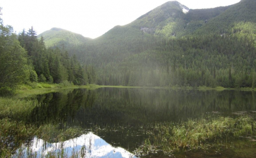
Goat Range. Paragliding from Meadow Mountain and top-landing in spring and summer incredible as well

Driving Directions:From the community of Meadow Creek, take the Meadow Creek road north for 3.1 km until you reach a fork in the road. Take the right fork onto the Meadow Mountain Forest Service Road, cross a bridge and keep to the left at all intersections until you reach kilometre 9.4. At this point take a right, and then a left at 10.3 km. For the remainder of the drive, keep right at all intersections . It’s a long drive. Meadow Mountain is at 28.1 km and the cabin is at 29.0 km. A high clearance vehicle is necessary , and 4wd is recommended as there are steep rough sections on the road.


Beaver Lake Rec Site

This beautiful lake is found in the narrow valley of Fitzstubbs Creek, backed by the 2300 m peaks of the Nakusp Range. It is popular with family groups, as it offers something for everyone. The level sites beneath trees are suitable for tents, campers or trailers. Long weekends find folks coming from far and wide to gather for reunions, do some fishing for Kokanee and rainbow trout, swim, bike ride, play bocce and horseshoes. For those who want to get away from the crowds, a small hidden lake joined to Beaver Lake by a narrow stream, is accessible by canoe. Canoeists will also find the inlet and outlet stream interesting. Mountain biking on the Wilson Creek Forest Service Road is popular. Keep your eye open for wildlife coming down to the creek for water. Boating restriction: electric motors only. 8 campsites and a boat launch.

Driving Directions:Turn off Highway 6, at Rosebery, onto the “East Wilson Creek Road”. This road soon turns into the “Wilson Creek Forest Service Road”. Follow this good 2 wheel drive gravel road. At 5 km the road forks, stay left. Just before the orange and white 20 km marker, turn left at the “Beaver Lake Recreation Site” sign onto a good 2 wheel drive dirt road. Follow this road for 400 meters to the campsite.

Box Lake Rec Site

SITE FEES IN EFFECT SUMMER 2014 Fees will be collected from May to October Annually at a rate of $12.00/night ($6.00/night for seniors). In the spring and early summer, trout fishing makes this a popular weekend retreat for area residents. The lake is stocked with both rainbow trout and eastern brook trout. On long weekends, Box Lake becomes the site for family reunions. Later in the season, the towering cedar and hemlock surrounding Box Lake campsite, provide a cool and shady retreat, while the sun beats down. The lake warms to comfortable swimming temperatures in mid summer. In the fall look for mushrooms under the cedar and hemlock trees. Boating restriction: electric motors only.

Driving Directions: From the junction of Highway 6 and 23 in Nakusp, travel east on Highway 6 towards New Denver for 10 km. About 2.5 km before the Box Lake turn off, you will begin to get views of the lake from the highway. At 10 km, look for a brown 4×4 post with white lettering, signed “Box Lake” on your right. Turn off Highway 6 at this sign, onto a good 2 wheel drive dirt road. Proceed 1.9 km to a sharp right turn, which will take you into the recreation site.

Cameron Lake

Cameron Lake is a popular fishing spot best suited to cartop boats and canoes. It is about 2 km long with an irregular, marshy shoreline and a mud bottom. The campsite faces east catching the early morning sun. Later in the day a mixed forest of mature trees shade the site.

Driving Directions:Access from Arrow Park Ferry: At the ferry terminus set your odometer. Your odometer readings will not conform to the km signs on the road. Within 200 meters of leaving the ferry, turn right onto the road marked “Saddle Mountain Road Revelstoke”. Follow this road, past the “Saddle Lookout” road, for 11.6 km to the junction with the “Low Pass Road”. Reset your odometer. Stay right following the lake on the “Blackie Rogers Road” for another 12.9 km to a major intersection marked “Fostall Point”, “Fostall Road”, “Blackie Road” and “Cameron Lake Road”. Turn left onto the “Cameron Lake Road”. Reset your odometer. Stay on the “Cameron Lake Road” for 6.2 km, passing “Branch 10” and other new roads. At 6.2 km the road forks again. This time take the right fork. The lake will be visible soon, as the recreation site is 1.8 km from this last junction. Alternate access from the Fostall Road: Cameron Lake can also be accessed from near the “17 km” sign on the “Fostall Road”. From the “Fostall Road” to Cameron Lake it is 5.1 km. This road has some steep, rough sections. A 4×4 vehicle with good clearance is recommended.