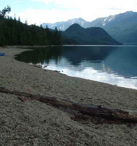
Sunshine Bay has a long history. Two kukuli across the road from the recreation site attest to occupation by First Nations people long before recorded history. The remains of a log cabin on the site is of more recent vintage. Sunshine Bay offers a crescent shaped, south facing beach and protected campsites under a pine stand. Nearby, the mouth of Sunshine Creek promises good fishing. The road past Sunshine Bay offers good hiking. When the water in the Lower Arrow Lake is down, beach combing is a relaxing past time. It is difficult to get a boat down to the water at Sunshine Bay, as the bank drops off abruptly. A flight of stairs goes from the campsite to the beach. A canoe, kayak or inflatable zodiac would be your best bet. The closest good boat launch is at the Renata turn-off, at 18.7 km.
Driving Directions:Just before the yellow gates in Syringa Creek Provincial Park, turn right onto the “Deer Park Forest Service Road”. Follow this narrow, good 2 wheel drive gravel road to the community of Deer Park. In Deer Park, turn right. There is a small “Renata” sign, pointing the way. Within a half kilometre, the road forks. Take the upper fork to the right, continuing along this road. At 18.7 km the road forks again. Left takes you to the lake shore, and the boat launch to Renata. Go right to continue on to Sunshine Bay. From here the road deteriorates, and a high clearance vehicle is recommended. At 25 km you pass through the old fruit growing community of Broadwater. At the junction in Broadwater, take the right fork onto the “Sunshine Creek Forest Service Road”. Continue along this road, staying right at the fork just before the 31 km sign, and passing over the Two Bit Creek bridge. The last 3 km descend steeply to Sunshine Bay Recreation Site at 34 km.
